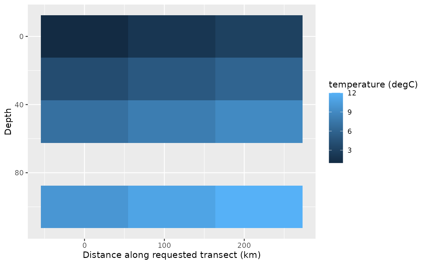
viz.transect() delegates ordered path matching and scientific selection to
cube_transect(), then draws either a distance-by-depth section or a
distance-by-value horizontal transect. It never interpolates values or
densifies the supplied path.
Usage
viz.transect(
  x,
  path,
  variable,
  time = NULL,
  depth = NULL,
  lon_col = "longitude",
  lat_col = "latitude",
  id_col = NULL,
  match = c("exact", "nearest"),
  tolerance = NULL,
  mode = c("auto", "section", "horizontal"),
  distance = c("requested", "matched"),
  limits = NULL,
  na.rm = TRUE,
  reverse_depth = TRUE,
  points = TRUE,
  title = NULL,
  subtitle = NULL,
  caption = NULL
)
Arguments
- x
A valid
<ocean_cube>using the memory or NetCDF backend.- path
An ordered path accepted by
cube_transect(). It is passed unchanged;sf/sfcpaths are rejected by the extraction contract.- variable
One non-empty, non-missing variable name.
- time
NULLfor a singleton time axis or one stored time value.- depth
Optional stored depth selector passed directly to
cube_transect(). A section requires at least two depths; a horizontal transect requires exactly one physical depth or the surface depth.- lon_col, lat_col
Column names containing path longitude and latitude.
- id_col
Optional path column used as point identifiers.
- match
Matching method passed explicitly to
cube_transect(). The new visualization API defaults to exact matching. Nearest matching may warn when no scientifictoleranceis supplied.- tolerance
Optional nearest-matching tolerance passed unchanged to
cube_transect().- mode
Plot mode.
"auto"chooses a section for two or more depths and a horizontal plot for one physical depth or a surface cube.- distance
Cumulative distance used on the x axis.
"requested", the default, follows the user path;"matched"follows the matched grid path. Point-to-cellmatch_distance_kmis diagnostic and is never the x axis.- limits
NULLor two finite numeric scale limits in increasing order. Values outside the limits are squished to the boundary without removing observations.- na.rm
A single non-missing logical value. Missing values are removed before plotting when
TRUE; they are never replaced or interpolated.- reverse_depth
A single non-missing logical value. In section mode,
TRUEplaces the surface at the top and greater depths downward.- points
A single non-missing logical value. In horizontal mode,
TRUEadds points to the line; it does not alter a section plot.- title, subtitle, caption
Optional character scalars used as plot labels.
Value
A ggplot object with the resolved variable, time, mode, distance,
depth range, backend, matching settings, maximum point-to-cell distance,
and path point count recorded in oceancube_* attributes.
Details
cube_transect() is the sole data-selection and coordinate-matching layer.
viz.transect() does not recalculate distances, access a backend reader,
aggregate duplicate cells, interpolate, or reorder the requested path.
Regular distance-by-depth grids use geom_raster() and irregular grids use
geom_tile(). Repeated path positions that create duplicate distance-depth
cells cannot define a two-dimensional section and are rejected; remove the
zero-length segment or choose the alternative distance metric when valid.
NetCDF extraction remains selective through cube_transect().
Examples
if (requireNamespace("ggplot2", quietly = TRUE)) {
  values <- array(1:12, dim = c(3, 1, 4, 1, 1))
  cube <- ocean_cube(
    lon = c(-80, -79, -78), lat = -11, depth = c(0, 25, 50, 100),
    time = as.Date("2020-01-01"), data = values,
    vars = "temperature", units = "degC"
  )
  path <- data.frame(
    longitude = c(-80, -79, -78), latitude = rep(-11, 3)
  )
  viz.transect(cube, path, "temperature", depth = 0)
  viz.transect(cube, path, "temperature", mode = "section")
}